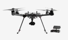
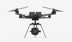
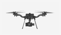


Flux
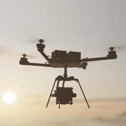
On-Site LiDar Mapping
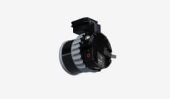
Worlds most efficient LiDAR solution - Go from scan to decision in minutes with Freefly Flux LiDAR systems
- CHANNELS 128 Lasers
- ACCURACY 3-5 cm
- RANGE 400 m
Light, Fast & Accurate
Freefly Flux is the lightest and most simple lidar workflow ever. Outline your scan area, fly the mission, grab the USB C drive from the scanner and visualize your data in minutes using Apple iPad.
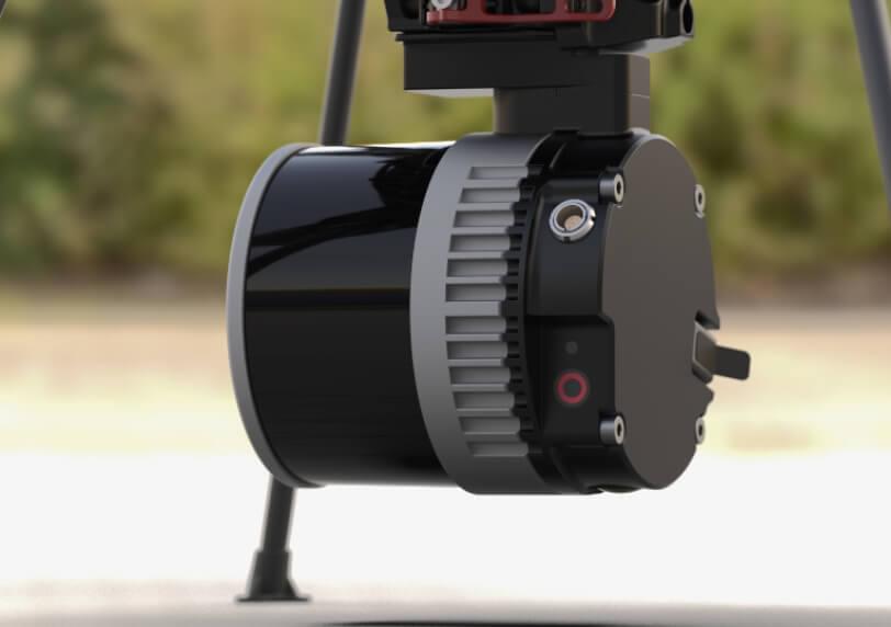
Three systems, one speed… fast!
Which system is right for me? Choose from Livox, Hesai, and Ouster scanners to fit your use case.
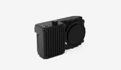
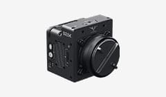
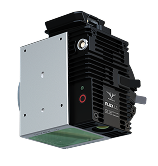
FLUX H1
$ 32,950.00

Hesai XT-32MX offers incredible performance in a ~700g payload. Professional level results in a package that can travel worldwide with ease.
| 32 laser channels |
| +/- 3 cm (1.2 in) accuracy |
| Triple Returns |
| 300m range |
| 360° x 40.3° FOV |
| 715g |
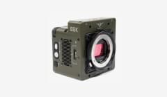
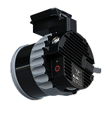
FLUX O1
$ 32,950.00
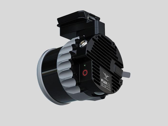
NDAA compliant, the Ouster OS1 is ready to scan your critical infrastructure.
| 128 laser channels |
| +/- 3 cm (1.2 in) accuracy |
| Dual Returns |
| 200m range |
| 360° x 40° FOV |
| 663g |
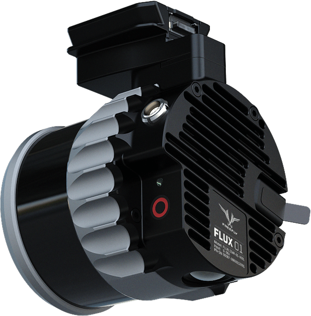
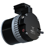
FLUX L1
$ 13,995.00
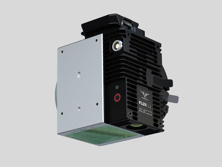
Entry level lidar that also allows for non-repetitive scanning for power lines and other hard to image items.
| 6 laser channels |
| +/- 5 cm (2 in) accuracy |
| Triple Returns |
| 450m range |
| 70° x 77° FOV |
| 715g |

Effortless On-Site Workflow
Incredibly simple, with no calibration, effortless data capture and on-site processing.

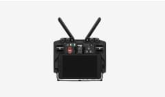
01
PLAN YOUR MISSION LIKE A PRO
Use your preferred mission planning app to map out your survey.
Set the altitude between 10 and 150 meters.
Adjust the lateral overlap to match the flight track separation for optimal coverage.
Choose a speed between 1 and 15 m/s to balance point density and mission duration.
(This ensures precision and efficiency, whether you’re surveying dense vegetation or urban landscapes)
02
PRESS RECORD & TAKE-OFF
With a single press of the REC button, you're ready to collect up to 1.9 million points per second.
The system automatically syncs IMU, GNSS, and LiDAR data, storing it securely on the USB-C flash drive.
Spend less time worrying about equipment and more time focusing on your mission.

03
SKIP CALIBRATION - FLY FREELY
Forget about time-consuming calibration passes or tricky flight patterns.
Take off vertically, fly directly to your first waypoint, and start surveying immediately.
Our advanced processing ensures that strips align perfectly every time.
This streamlined approach saves time and boosts efficiency, giving you flawless results faster.

04
SECURE YOUR DATA IN SECONDS
After landing, simply press STOP to finalize the recording.
Your data is instantly saved to the USB-C flash drive and fully prepared for processing.

05
PROCESS THE LiDAR DATA ON-SITE IN MINUTES
Don't wait to get back to the office. While still on-site, use our app to import the data from the USB-C flash drive into a new project.
Add the ground station's RINEX file for the GNSS post-processing.
In just a few minutes, a highly accurate, dense point cloud is produced and ready for analysis. It has never been easier to verify and check that the dataset is full and complete.
Whether it's vegetation mapping, terrain modeling, or infrastructure inspection, you'll have actionable insights on the spot.

Review these customer scans
Real world examples from real world customers
FOREST + ROAD - FLUX L1

Built to Perform, Built to Grow
Freefly Flux is designed, assembled, and tested in house to allow seamless integration into Astro and Alta X and allow us to optimize performance. We use the latest low noise IMU’s, dual ublox X20 GNSS integrated into each antenna, and a 20mp camera for colorization.
